

Mapping
Kuzuri Kijiji, East Orange
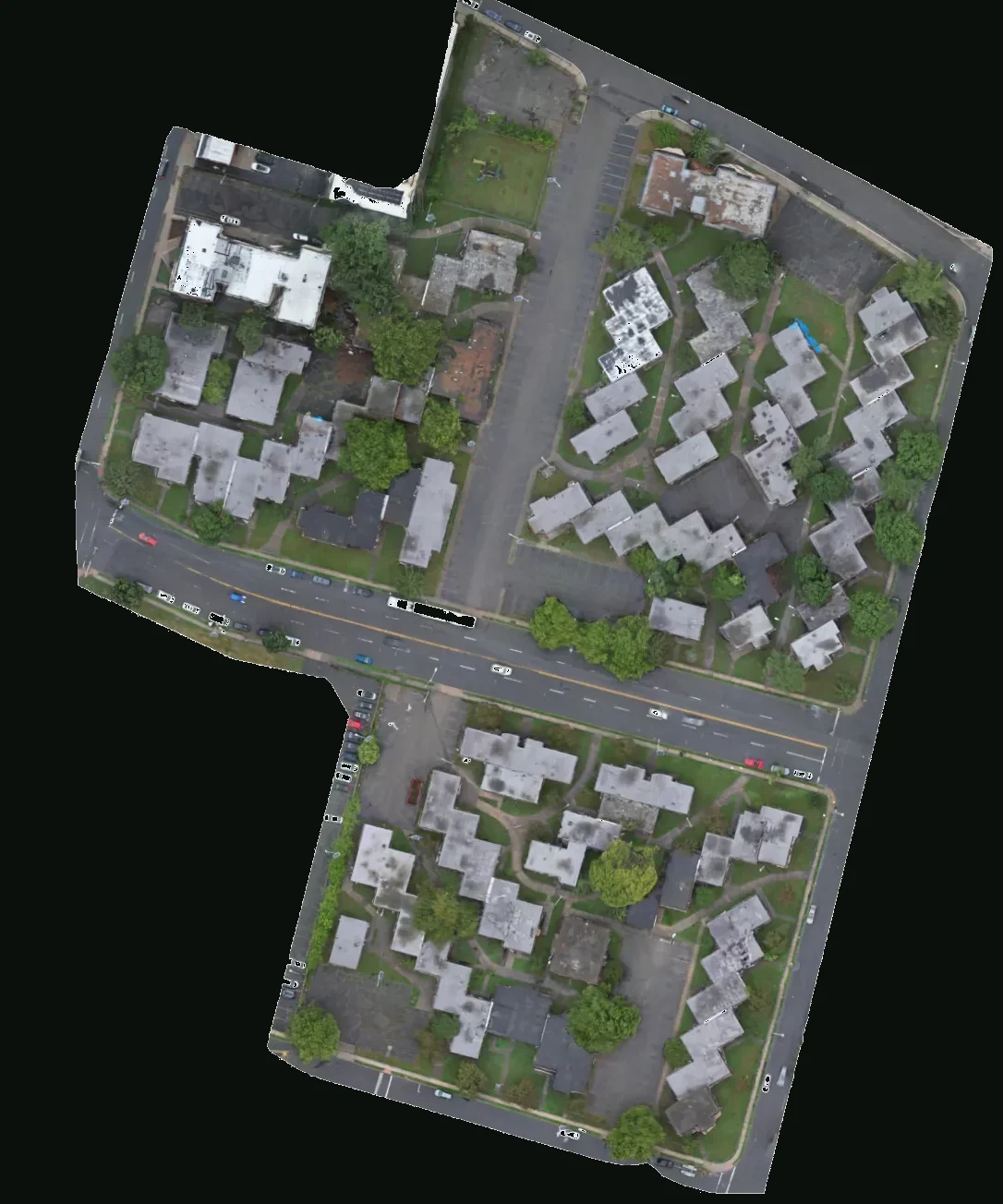
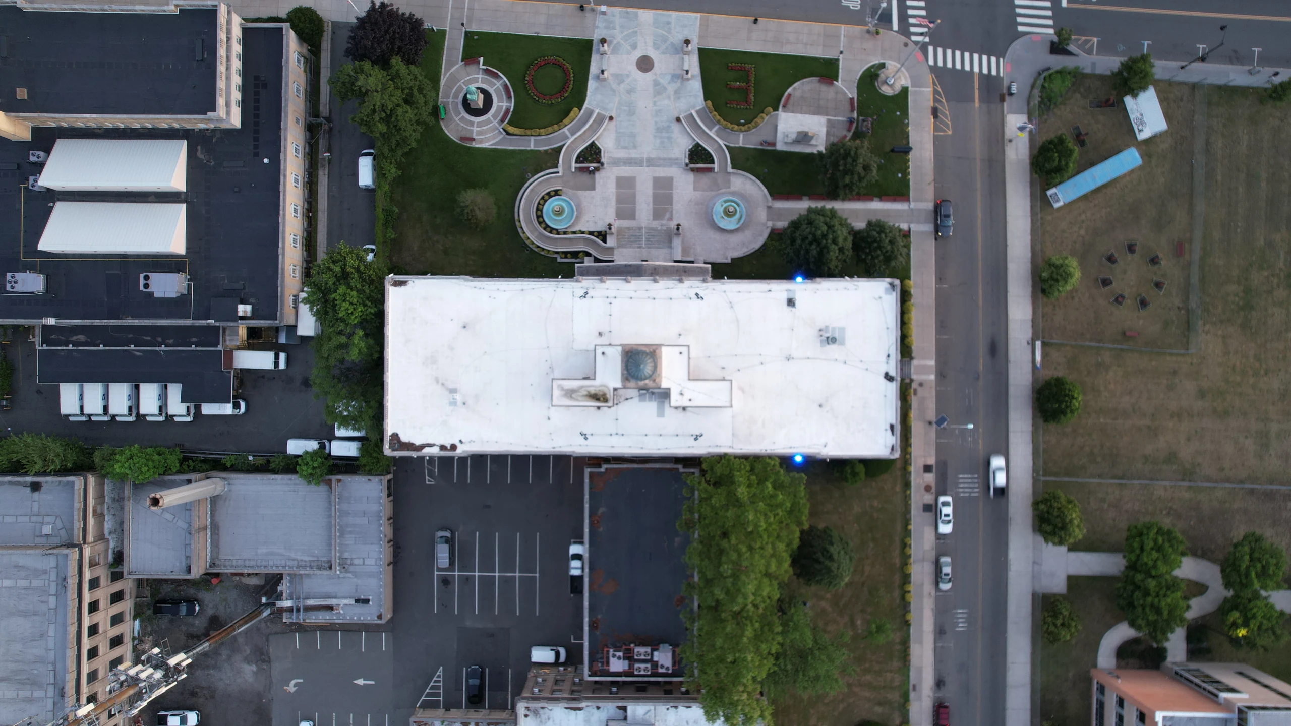
Kuzuri Kijiji — Swahili for Beautiful Village — at 19 Freeway Drive East in East Orange, mapped as a single orthomosaic. Townhouses, parking, access, and the lots around I-280 and the Garden State Parkway in one measured view. Visual mapping of the existing complex, not a certified survey and not a rendering of the redevelopment.
What this capture was for.
Kuzuri Kijiji — Swahili for Beautiful Village — at 19 Freeway Drive East in East Orange, mapped as a single orthomosaic. Townhouses, parking, access, and the lots around I-280 and the Garden State Parkway in one measured view. Visual mapping of the existing complex, not a certified survey and not a rendering of the redevelopment. Captured by Baron Aerial Media — planned around a usable output, not a stock plate.
Kuzuri Kijiji opened in 1973 as a cooperative townhouse community designed by East Orange architect Edward Bowser. The name is Swahili for Beautiful Village. The original 8.2-acre, 247-unit complex sits near the I-280 / Garden State Parkway interchange. The complex has been vacant and fenced for about a decade. This July 6, 2026 dataset maps the existing buildings and the surrounding block (~11.3 acres in the AOI) — it is not a drawing of the approved redevelopment (662 apartments, 1,000+ parking spaces, ~30,000 sf commercial, PILOT adopted December 2025). Processed in DroneDeploy, standard mode, 100% oblique, camera GPS RMSE about 11 ft. Visual and relative-elevation context — not RTK survey control, and not a sealed plat.
A submitted brief starts a feasibility review. It does not authorize a flight, confirm a date, or create a contract. Conditions and approvals can change what is operationally possible.
Mission
Photogrammetry / site map — Kuzuri Kijiji, East Orange
Outputs
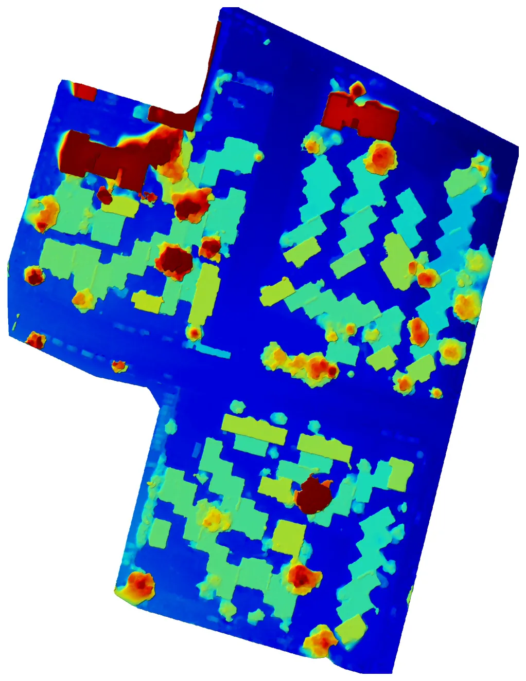
Orthomosaic + DEM + coverage report
Category
Mapping
Site
Kuzuri Kijiji · 19 Freeway Dr E, East Orange
Opened
1973 · 247 townhouse units on 8.2 acres
Captured
Jul 6, 2026
Frames aligned
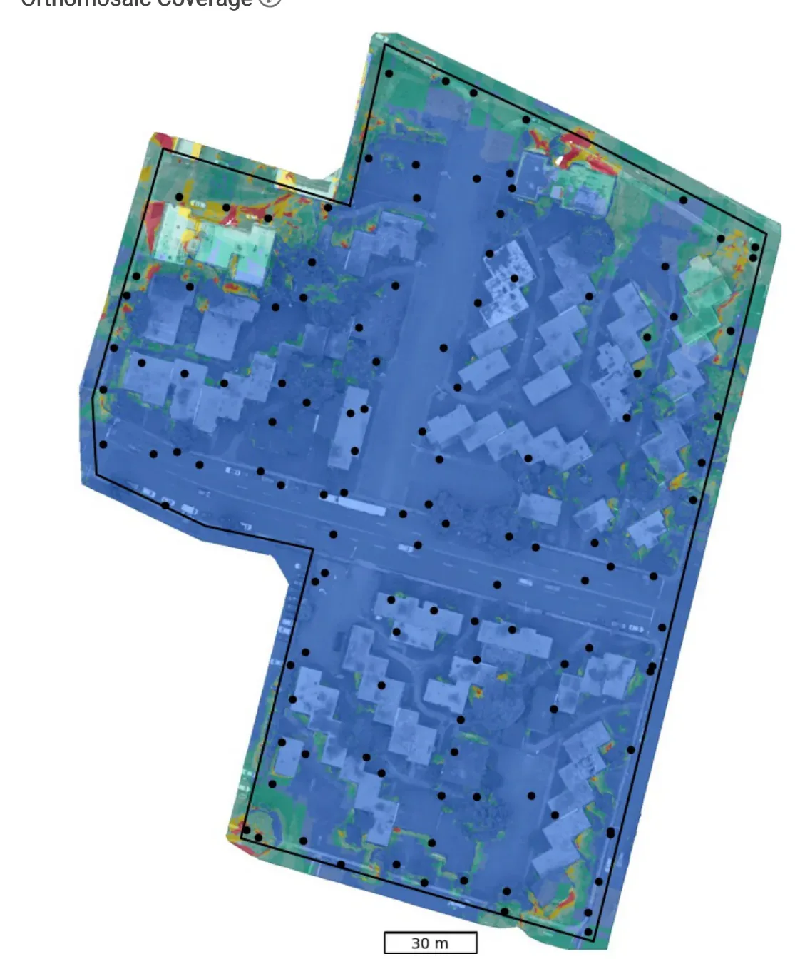
123 / 123 (100%)
Coverage
99.7% of AOI
Mapped area
491,250 ft² (~11.3 acres, complex + surroundings)
Ortho GSD
1.24 in/px
DEM GSD
4.98 in/px
Point cloud
5.1 million pts · 10.5 pts/ft²
Sensor
DJI FC3411
How photogrammetry is flown
Kuzuri Kijiji. Four different paths. Four different maps.
Kuzuri Kijiji, East Orange — 19 Freeway Drive East, July 6, 2026, 123 frames, 99.7% coverage, 1.24 in/px. The 1973 cooperative townhouses (Beautiful Village) and the surrounding block, near I-280 and the Garden State Parkway. Switch a pattern to see what nadir, crosshatch, and oblique actually do. The path we flew is labeled.
Kuzuri Kijiji — 100% oblique · live path
Flight pattern
Kuzuri Kijiji — 100% oblique
Kuzuri Kijiji — 19 Freeway Drive East, East Orange, near I-280 and the Garden State Parkway — was flown entirely oblique. Coverage of the AOI was 99.7%. Camera GPS RMSE is about 11 ft. This maps the existing 1973 townhouse complex and surroundings, not the approved 662-unit redevelopment. Useful visual and relative-elevation context. Not RTK survey control, and not a sealed plat.
- Overlap / capture
- 123 frames aligned · Jul 6, 2026
- What you get
- 1.24 in/px ortho · 4.98 in/px DEM · 5.1M pts
Ground texture is the July 6, 2026 orthomosaic of Kuzuri Kijiji, East Orange — a real Baron Aerial Media mapping site, not a generated grid. Switch patterns to see how the path changes what the reconstructor can solve.
Site model
Drag to orbit. Scroll to zoom.
Orthomosaic draped on the DEM from the same Kuzuri Kijiji capture. Grab the model — it is a 3D packet, not a JPEG that wiggles.

How the mesh is built
Camera stations, not a mystery box.
After capture, each frame is aligned to a 3D model. Numbered spheres are camera stations. The colored overlay is coverage. A mapping packet can include this diagram with the orthomosaic so a GC or planner can see how the model was built. This still is a reconstruction report from Baron Aerial Media processing — a single-building mesh, not the Kuzuri Kijiji ortho above.
Deliverable stills
More work
Back to gallery →
Altitude Changes Everything
From Rooftops to Bottom Lines.
Tell us the site and the decision the media has to support. We will scope the flight, the deliverables, and whether it is operationally feasible under Part 107.
Plan a Drone Mission